
November 1 – 9, 2013

local Tongan outrigger canoe ~ Hunga Lagoon, Vava'u
Good-bye Vava’u: Clearing out of Tonga can be done in a few ways. Many people make their way to Tonga’s southern Tongatapu Group where they provision for the passage and then clear from Tonga to New Zealand. While still in Vava’u, we chose to fully provision in Neiafu, and then pay a visit to the immigration office. Vava’u immigration gave us our papers for final clearance from Tonga via the Ha’apai Group. We would only have to stop in Pangai on Lifuka Island in Ha’apai to finalize the paperwork.
Once we had our clearance papers in hand, we met up with a bunch of our friends for one last potluck on the beach in Port Maurelle. While we ate, there was much discussion about the weather window and when would be the best time to sail southward. The crews of Sueño and Full Monty agreed to sail for Ha’apai that night. As soon as we returned to our boats with full tummies, we proceeded with offshore preparations and our anchors were hauled for the 12-hour sail.
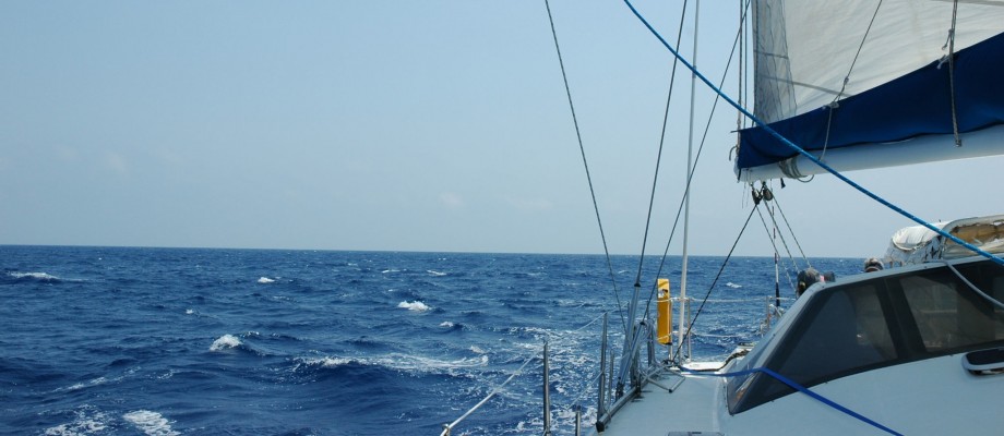
The shortest rhumb line to the Ha’apai Group is to sail south out of Vava’u. However, for a couple of reasons we chose to sail the western route. First, the wind was light, and we needed to have a course that put the wind more on our beam. Also, in order to have enough sunlight upon arrival to Ha’apai, we needed to sail at night. Tonga, and especially the Ha’apai Group, are known for their many dangerous and uncharted reefs. (We personally know a boat that ended up on one of those reefs in the middle of the night!) Therefore, we exited the Vava’u Group around the northern end of Hunga Island, and we sailed in the deeper waters down the western side of Tonga.
The night was calm and the sailing was easy. By mid-morning, we were making our approach to Haano Island in hopes of finding a not-so-rolly anchorage. As the day progressed, so did our distance traveled. We searched spot after spot, even dropping the anchor for lunch, but we weren’t satisfied with an anchorage until we reached the southern end of Uoleva Island.
Uoleva & Lifuka Islands: The islands of the Ha’apai Group are low lying and their anchorages are mostly unprotected from wind and swell. Therefore, it is highly recommended to only visit these islands when the winds are easterly and the swell is small. Even when it is calm, there is a constant swell that wraps around the islands and into the anchorages. The southern end of Uoleva Island has a large spit of land, plus additional reef which helps to enclose the anchorage, but it’s still slightly rolly. We never went ashore, but we had fun snorkeling along the surrounding reef. After two nights at Uoleva, we needed to continue our journey.
Before we could continue with any exploration and fun, we needed to make a quick 5-mile detour back up to Pangai to finalize our clearance from Tonga. s/v Sueño would be clearing out in Tongatapu, so they went ahead to scout out our next anchorage. We would meet back up with them by the end of the day.
The anchoring basin at Pangai was easy to enter, and easy for dropping the hook. We were the only sailboat among small, local fishing boats. We tied the dingy at the wharf and made the quick walk to the immigration office. We only knew the general direction to walk, but it was easy to get directions from any person passing by. Once completing the immigration process, we stopped at a small grocery on our way back to the dinghy. We didn’t have enough cash, so Wil was able to run to a nearby bank and return with the necessary money. Once official business was completed, we joined Sueño at Uonukuhahaki Island.
Uonukuhahaki Island: Our afternoon at Uonukuhahaki Island was spent relaxing. David & Wil went in search of lobster, Nathalie and I snorkeled and chit-chatted it up in the water, and the kids played on the beach and in the water. Unfortunately, the dads came home empty handed, but it was all still fun.
Numuka Island (Otu Tolu Group): The next day, we were ready to depart Uonukuhahaki Island, and we’d chosen Numuka Island in the Otu Tolu Group as our next destination. However, the day was overcast with some drizzle, and it’s nearly impossible to move a boat around the Ha’apai and Otu Tolu Groups without the sun to light up the treacherous reefs. Ideas were tossed around, and then we finally settled on making a daring dash to the nearest pass, Ava Mata. Once outside the pass, we would sail down the reef to the next pass, and fish along the way.
Fishing along the barrier reef in the southern most Ha’apai Group was the most incredible fishing we’d had since the Marquesas in French Polynesia. Both Sueño and Full Monty pulled in fish after fish. There were tuna, jacks, mahi mahi, and barracuda. They were plentiful, and they were big. We actually got tired of the “FISH ON” call! It was awesome!
Luck continued to be with us. As we got to the end of the Ha’apai barrier reef, and needed to enter the scattered islands of the Oto Tolu Group, the sun came out. We were able to eyeball navigate our way to Numuka Island. However, once we got there, we had a difficult time finding an anchorage that was protected from the wind and without too much coral. After circling Numuka Ika a couple of times, we finally dropped the hook on the island’s east side and behind a reef. All were exhausted from the day’s fishing excitement, but some of the crew still managed to swim and explore ashore.
Kelefesia (Otu Tolu Group): Our final Tongan island before the impending New Zealand passage!
Approaching wild and beautiful Kelefesia Island requires strict attention to navigation. Over the past couple of years, we’ve grown accustomed to using eyeball navigation with respect to reefs. However, we had never before come across “blind rollers”. We saw blind rollers labeled on the chart and wondered what exactly that meant. It didn’t take long for us to find out.
As we were looking for our final turn toward Kelefesia, the water between us and the anchorage appeared to be deep enough. We had about 10-15 knots of wind with a 2-meter long period swell. According to the chart, where the blind rollers were supposed to be, we could see nothing but water that was deep enough for us to cross. I was at the helm, and Wil, while keeping a watchful eye from the bow, indicated for me to make our turn toward the anchorage. I was nervous and unsure about our premature turn, and for good reason. Just as we were getting ready to cross the “blind rollers” area, some swell moved through. Suddenly, the normal, gentle swell stood up to a steeper, 3-meter wave as it went from the deeper water to the shallower reef at about 5 meters deep. Thank goodness, I managed to make the hard turn back to starboard before getting caught in the steeper wave! Once we got ourselves back to where we needed to be, and around the blind rollers, we looked back at them and could fully appreciate their meaning.

notice the area of "blind rollers"

lots of reef & coral on every approach!
Our time in Kelefesia was mostly spent preparing ourselves and the boat for the New Zealand passage, and spending some last minute quality time with our good friends on s/v Sueño. Sueño’s next stop would be Tongatapu, where they would exchange Nathalie & Noemie for one crewing uncle. The girls would get on a plane to New Zealand, while David, Nathalie’s uncle, and the boys would sail the boat. When we departed Kelefesia, we would be sailing directly to New Zealand, with a possible stop in Minerva Reef.
Boat preparation included the normal offshore preps (running jack lines, checking engines, making sure everything was secure and stowed, etc). However, this time we also needed to go through all of our provisions and bring out foods that wouldn’t be admitted to into New Zealand. I placed a bin of such foods in the main salon, and our goal was to consume the majority of those foods prior to arrival in New Zealand. We also needed to make sure we weren’t carrying any critters (especially in wood products or baskets), so the boat received a good cleaning prior to our departure.
Part of our mental relaxation was achieved by snorkeling the area, and as usual, the kids usually played on the beach or in the water. The surf surrounding Kelefesia looked amazing, and if we weren’t getting ready to depart for New Zealand the next day, Wil would have taken a board out. We wanted no injuries or infections to deal with on the passage.
Unfortunately, other kid boats back up in Vava’u had been kind enough to share a cold virus with everyone. Eventually, the Sueño kids suffered from the bug, and then the night before we were to set sail for New Zealand, Justine fell sick with a low grade fever and general cold symptoms. (Looking back at our past history of big passage departures, this came as no surprise!) Based on the knowledge that other kids only suffered with a fever for no more than 48 hours, we felt like it would still be okay to keep our departure for the following day.
Little did we know, the passage to New Zealand would bring us some of our most challenging moments . . .

northern tip of Kelefesia Island

southern tip of Kelefesia Island ~ 1/2 mi from N to S

looking NW from Kelefesia ~ lots of reefs!

a tricky anchoring between reef & coral heads

Kelefesia is a rugged & wild beauty

yellow-lipped sea krait

sea snake trying to board the boat & dinghy

pigs ~ for when fishermen stay on Kelefesia

building a nest somewhere

birds collecting debris for their nests
