
October 12 – 14, 2012
~Part One~
Even before we departed Annapolis, I studied the offshore weather for our pending passage around Cape Hatteras. My initial weather studies took place on a Tuesday afternoon, and I told Wil that we could possibly be waking up in Beaufort on Sunday morning. He laughed at me and said, “No way!” He wanted us to take our time and enjoy the sights without having to push hard to get somewhere, as well as show the kids the Navy ships in Norfolk. While that would be a wonderful thing to do, Mother Nature was providing us with an ideal weather window that we just couldn’t pass up.
The treacherous waters and shoals just off Cape Hatteras are referred to as the Graveyard of the Atlantic because many ships have been lost off this part of coastal North Carolina. This area has a reputation for its own weather patterns which can be responsible for storm development. Therefore, many people, including other sailors, look at us in surprise when we say we’re going offshore and around Cape Hatteras. We explain to them that our mast is too tall for the fixed bridges along the Intracoastal Waterway, and that we must take the outside route. With careful planning and preparation, the passage past Cape Hatteras can be just fine.
When we picked up the anchor from Cockrell Creek on the Friday morning, the winds were forecasted to blow 15-20 knots out of the northeast. We would sail all day, and the rest of the way down the Chesapeake Bay, with the wind on our stern. Instead of stopping in Norfolk for the night, we would sail on past, over the Chesapeake Bay Bridge-Tunnel, and out to sea. Throughout our first night offshore, the winds would gradually increase to 30 knots, and continue to blow from the northeast. Seas were expected to be 5 to 7 feet, also out of the northeast. On Saturday, the winds would continue to blow from the northeast, slowing slightly to about 20-25 knots, with 2 to 4 foot seas. These conditions would be ideal for an afternoon sail past Cape Hatteras. The daylight pass would allow us to stay close to shore and out of the north flowing Gulf Stream without endangering ourselves by the close proximity of Diamond Shoals. By Saturday night, and in time for our turn towards Cape Lookout, the winds would switch to the east, and diminish to 5 to 10 knots. Disregarding a couple of mishaps, the passage was as near to perfect as one can get.

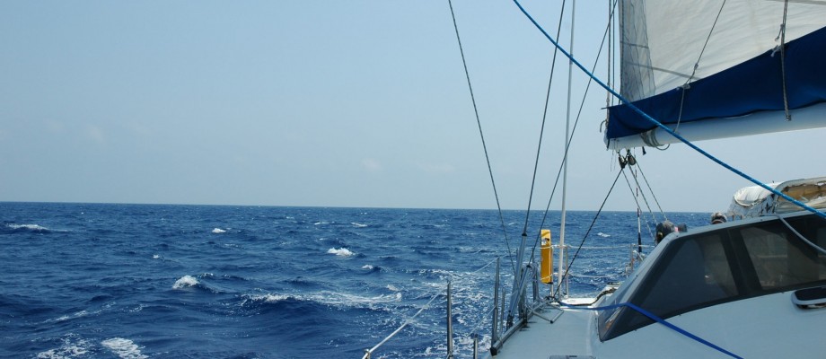
Chesapeake Bay Bridge-Tunnel on the horizon

northern side of the bridge-tunnel
As we were approaching the Chesapeake Bay Bridge-Tunnel, evening was upon us, and we were anticipating the long night ahead. I went down to take a nap, while Wil held watch. I woke to knocking on the hatch above my head, and Wil telling me to get on the VHF. Groggy from a sound sleep, I was trying to comprehend what the person on the other end was saying. “Catamaran sailing south from the Chesapeake Tunnel, this is the Cape Henry Tower. What is your intention?” Nervously, I stumbled through words, trying to explain that we were heading offshore, south, and to Beaufort, NC. As I became more awake, I realized that the Cape Henry Tower was responsible for all incoming and outgoing shipping. Our AIS had not been on, so they could only see us on radar, without knowing our intended course. The tower informed me of all incoming ships, and I let them know that we would turn on our AIS and stay south of the channel.
Eventually, it was my turn to be on watch. We were still sailing parallel to the shipping channels. However, we were coming to a crossing of paths, so to speak. One channel brings ships in and out of Norfolk. The other channel leads to Baltimore. As we were approaching this crossroads, I noticed the starboard green light on a ship that appeared to be heading to the Norfolk channel. If the ship continued on its course, we would collide. Wil and I discussed what to do. We had been told a car carrier freighter would be traveling up the Chesapeake Channel, and we had said we would stay south of this channel. If we changed our course, we would cross into the Chesapeake Channel. However, due to the ship we saw in front of us, we chose to turn away from the oncoming ship. As we made our turn into the channel, the ship suddenly turned, and I could see his red and green bow lights. This meant that his bow was definitely pointed in our direction! Then, before we knew it, the ship had completed his full turn up the Chesapeake Channel, and we were seeing his port red light. Worst of all, we were in the Chesapeake Channel and we were on a collision course! As we immediately changed course to get out of the channel, the ship hailed us on the VHF, asking if we saw him coming, and that we needed to head west. We apologized for any confusion, and very quickly found the south side of the channel again.
As the ship passed by, even though it was dark, we could see the entire ship outline, as well as the orange color of the hull. These guys are big and fast, and not anything to tangle with. That one was way too close for comfort!
~to be continued~
