
October 8 – 11, 2013
During a stormy night in Tonga, there are a handful of us who learned or were reminded of some extremely valuable lessons when it comes to boat and crew safety with respect to Mother Nature. Luckily, our group of boats and crew were unharmed, but sadly, a local fisherman lost his life that night, leaving behind a wife and children.
Before I jump to the details of that heart-pounding night, using my simplistic terms, I’ll begin with a little information about weather forecasting in the tropical South Pacific, as well as how we obtain weather reports onboard.
Every morning when I first wake up, I boot up the laptop computer and pull in a weather report via the HF radio and Pactor modem. Most regularly, I look at a grib file, a Spot report, and a Nadi Fleet Code map.

recent grib file (extra large) showing our position, wind speeds, air pressure, wave heights, and precipitation

example of Spot information

- an email containing Nadi Fleet Codes
The above example of a Spot forecast shows (from left to right) date, time (utc), air pressure, wind speed (knots), wind direction (degrees), and rain (mm/hr). The blank column normally shows wave height (meters) and wave direction (degrees). I can either look at the forecast based on our current position, or I can request a forecast for a given course and speed over time.
When I recieve the Nadi Fleet Codes, I copy and paste them to a text only file. Then, I open the Nadi Fleet Code file in a PhysPlot map.

- PhysPlot map using Nadi Fleet Codes ~ shows isobars (black lines), high & low pressure systems, air pressure, frontal lines (blue) & convergence zones (brown)
Once I have all of this information, I mentally create my own forecast for what is really going to happen. While all general weather information is given, it is necessary to fill in some blanks, especially with respect to the South Pacific Ocean.
Firstly, the grib files and Spot reports usually underestimate the actual wind speed, and the percent error increases exponentially as the forecasted wind speed goes up. Forecasts give wind speed at approximately 10 meters above mean sea level and the wind is stronger higher up. Also, weather forecasts are most accurate up to 24-48 hours.
As general rule, wind can be estimated as follows:
-
add 1 Beaufort Scale level for the sake of planning
-
add 20% to the wind speed for a mast taller than 10 meters (ours is ~22 m)
-
add 20% for the maximum wind gust
-
add 10% for the Tropics or add 25% in temperate latitudes and the Southern Ocean

- In the South Pacific, when Force 6 winds are forecasted, don’t be surprised to see Force 10 wind gusts!
Other factors that come into play are the South Pacific Convergence Zone (SPCZ), low pressure systems, and frontal boundaries. A combination of any of these can wreak havoc on the weather, especially when all three are involved.
- The SPCZ: In the tropical South Pacific there are areas where east winds from the equator diverge toward the south and bump into southeast trade winds. These areas where the two winds converge are referred to as the South Pacific Convergence Zone (SPCZ). Shifty winds, strong squalls with 30-40 knots of wind, and heavy rain can be present in these unsettled areas. There is very little affect north of the zone. However, up to about 120 miles south of the zone, the strongest winds are felt.
- A Low Pressure System: A low pressure system is an area where winds rotate around an area of low air pressure. In the Southern Hemisphere, these winds move in a clockwise direction around a low pressure center. The lower the air pressure falls at the center, the deeper the Low becomes, accompanied by stronger winds and heavier rains.
- A Frontal Boundary: A front is the boundary between two air masses or systems. In this area, there is an abrupt change in the direction of winds at the Earth’s surface. The larger the air pressure or temperature gradients are between the two air masses, the greater chance for more severe weather.

- on the left ~ an example of a convergence zone (brown twig) being pulled into a low pressure system (closed circle) with a frontal boundary (red)
Prior to the severe weather that hit us in Tonga, grib files, Spot forecasts, and weather maps were showing a strong low pressure system approaching with a leading frontal edge. A strong convergence zone was also being drawn into the already intense low. The center of this Low was forecasted to pass directly over us, with a full clocking of winds. The grib file and Spot showed that, during the time period with the strongest wind, our forecasted wind would be 27 knots out of the southwest.
At that point in time, none of us had any idea of exactly how strong the wind would get that night. Knowing what I know now, and using the general rule described above, the strong winds that we experienced are completely understandable.
We all knew this weather was coming, and we knew we needed to tuck up somewhere with good anchor holding and protection from the strongest wind. At the same time that we needed to think about the bad weather, there was also a birthday party in the works, and a good beach was needed for all the planned kid activities. Over the few days prior to the weather event, we tossed around anchoring ideas, and also personally visited a few possible anchorages. When we thought the group had settled on one spot, another idea was added to the pot.
Eventually, the anchorage at Kenutu Island (Moorings anchorage #30) was chosen because there was reportedly good holding and a good beach. However, this anchorage is wide open to the southwest, and there were some of us who were not comfortable with the situation.
Coming into the anchorage, Wil and I had decided to remain open minded, but we were prepared to say no to the birthday party and go elsewhere if we felt unsafe. One boat that was arriving after us, called ahead with a couple of good questions concerning the protection of the anchorage, but they were assured that this anchorage was fine for all wind directions.
After having looked at the chart ahead of time, and prior to a final decision on our anchor spot, we explored the entire area within a mile of the birthday party location. We even checked out the area where a few of the boats were already anchored by the beach. It only took one drive-by for us to realize we didn’t feel good about being wide open to the potential southwest winds. We decided on our first pick, one mile to the northwest at the northern tip of Ofu Island.

- Using brown anchor symbols . . . Our anchor location at northern Ofu. The rest of the boats anchored near southern Kenutu.


- southeast Kenutu is wide open to the SW with only small reefs & sand banks to break up any wave fetch
Based on our decision to participate in the birthday party activities, we remained in the area and made the best anchoring choice we could with respect to the possiblity of strong SW winds. There are a few reasons for our anchoring choice.
1) By squeezing up as close to the NE end of Ofu, the island and a small spit of reef offered protection to the SW.
2) With a SW wind, in case the anchor were to drag, we would have more time for reaction before ending up on coral reef, rocks, or a beach.
3) The strongest winds were predicted for middle of the night. We had easy access to deep water in the event we needed a quick escape.

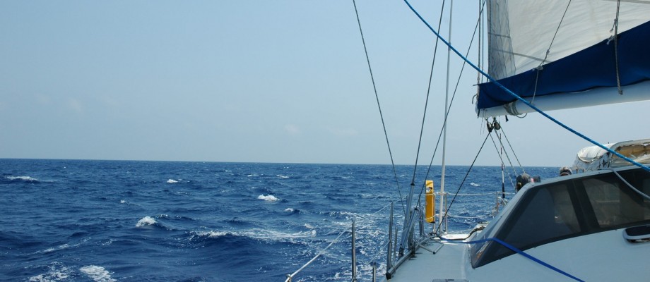
our anchor spot at northern Ofu Island

looking to the SSW from our anchorage

looking across to the southern end of Kenutu Island ~ can barely make out the other masts

evidence of unsettled weather rolling in
Sure, we had to dinghy a mile to the birthday party, but it was worth it. All the kids, as well as the adults, had a wonderful time with lots of fun games and plenty of good food. Eventually, it was time to return to our boats for the night and await the expected weather. Around 10 pm, we noticed lightening on the horizon to our southwest. Wil had hoped that meant most of the storm was missing us. After taking some mental bearing points (i.e. the other mooring lights and especially one little light on a tiny island nearby), we went to bed.
Midnight was the witching hour.
The strengthening wind woke us from our sleep. It didn’t take us long to realize that this was not your ordinary passing squall. The howling sound of the wind through the rigging was loud enough to rattle anyone’s nerves. The sheet lightening above blinded us with its brightness. The horizontal rain pelted any exposed skin when we tried catch a glimpse of our wind speed at the helm. At first glance, 42 knots easily! We suddenly felt the anchor make a couple of hops before it re-grabbed again.
Even though our adrenaline had kicked us into high gear, and I could still think and function normally, my arms and legs shook uncontrollably, almost as though I was cold . . . but I wasn’t. I also had to pee . . . badly! It never fails for me. The urge to pee is the first thing I need to do when I first get out of bed. But, when the winds were blowing near 50 knots, and there was potential for disaster, there was no time to even think about going to the head. Our boat needed our fullest attention.
Using a mask and snorkel for facial protection (and to be able to see!), Wil went forward to check on the anchor and bridle. The one-foot wave fetch was choppy, but the island and small spit of reef protected us from the bigger waves. The anchor chain and bridle remained completely taut with the wind. The strains on the anchor chain, bridle, and boat were tremendous. I suggested we use the engines in low idle to relieve some of the strain, and that seemed to put the boat at ease.
While we had chosen a more protected location than the other boats, the storm was no picnic. We could only imagine what the others were going through. When the storm was at its strongest, we couldn’t even make out the mooring lights across the water.
The wind had kicked up at midnight. We were completely on edge as it blew near 40 knots, gusting to 50 knots (58 mph), for nearly an hour. Both of us remained in the cockpit with the engines running for that first hour. Our nerves began to calm during the second hour, when the wind dropped into the 30 knot range, gusting to 40. We didn’t feel out of the woods yet, but we finally turned off the engines. We’d go inside for longer periods, but keep a close eye on the AIS anchor watch. It took until the third hour when the wind finally dropped into the 20 knot range, gusting to 30 before we could settle another notch. By this point, there was no need for both of us to remain on watch. While I went to bed, Wil slept with his head down on the nav table, so he could hear if the anchor watch alarm sounded.
This night was also the opening night for a big regatta weekend in Tonga. Many boats had gone to Neiafu Harbor for the festivities. The wind had ramped up about the same time that many intoxicated sailors were trying to make their way back to their boats. While we had been busy keeping watch on our situation, we could hear lots of VHF chatter. People were attempting to dinghy back to their boats during the strongest winds, and they weren’t able to go against the wind. Also, since Neiafu Harbor was so crowded with boats, and many moorings are too close together, people were having a difficult time keeping boats apart from each other. While Neiafu was more protected than our side of Vava’u, the harbor had its own sort of chaos.
The following morning was that beautiful calm after a storm. We were relieved it was over and ready to pick up where we left off. While it was still early, we noticed a local boat motoring around. The guy came over to see if we were okay. He was from the Mandala Resort on Fetoko Island, and he was checking for anything out of the ordinary. He noticed that we were not in a normal anchorage spot and wondered if we’d washed up on the reef. We were very happy to tell him that all was okay, and also thanked him for leaving their light on throughout the night. It was the only light that had remained visible for keeping our bearings during the storm.
Over the next several days, we learned a little more about that night. The boats that had anchored at the south end of Kenutu Island had a far worse experience than us. They were the receiving end of wave fetch over a meter high. As the boats hobbied up and down in the waves, their bows went into the water with each wave. There were reports of broken snubbers, dragging anchors, and attempts to re-anchor. Most of them had beach or coral reef behind them, so they had very little reaction time. A couple of boats who were better off than the rest, realized that they should have known better than to put themselves in such a situation. Everyone has agreed that this was something never to repeat.
After the stormy night, regatta activities continued throughout the weekend. Eventually, many boats (both spectators and race contestants) gathered near Mandala Resort. After the regatta, the people who run the Mandala Resort began checking to see if any of the regatta boats were missing a crew member. They had found a man who had washed up on their beach, and they were trying to identify him. Later, it was discovered that he was a local fisherman whose boat had overturned in the storm, and he drown because he didn’t know how to swim. The restaurant on Tapana Island hosted a major fundraising dinner in order to raise money for his grieving family. While we were unable to attend, we had heard that the dinner had completely sold out due to the overwhelming support from the cruisers.

many regatta boats anchored near Mandala Resort

Polynesian sailing canoe catamaran
Sailors, fishermen, and other mariners, we are all people of the water. We must respect the forces of Mother Nature and prepare for her the best we can. No matter what, the sea remains our passion.
