new zealand ~ let me shake your hand

November 18, 2013

Even though we were completely and utterly exhausted from our challenging 10 days at sea, our friends on Pacific Flyer convinced us to go for free rum punch and nibbles at the All Points Rally tent that evening. Usually, once we’ve made landfall after a long passage, we try to power through without naps, and then we don’t have trouble sleeping through our first night at anchor. Therefore, attending the All Points function made sense. We would also get to say hello to several other cruising friends whom we had not seen in awhile.

Foggy minded, we walked up and into the crowded rally tent. Suddenly, something began to happen that we would have never expected in our lives. We had barely made it five feet inside the tent, and that’s where we stayed for the entire evening. Person after person came up to talk to us. The people who we knew gave us hugs. People who we didn’t know introduced themselves. They were all letting us know that they had been rooting for us on our troubled passage, as well as praising us for our strength and determination. We’d had no idea that so many people had been listening to our saga on the SSB!

The craziest thing . . . all these people had been most worried about me! With two feverish kids, a captain with vertigo, and no autopilot, they wondered how I managed. One guy, who crewed the passage on another boat, walked up to me, introduced himself, and said that he just had to shake my hand. He told me that they had listened to my daily reports, and regardless of how tough things were, I always sounded upbeat. They loved how I always stated our problems, but then ended my transmissions with “. . . but, all is well onboard.” He said that I was an inspiration.

I was in shock. We were in shock. We didn’t feel like we’d done anything that spectacular. There are people sailing on the high seas that have had much tougher passages than ours ever came close to being. Sure, we had our challenges, but we were never in any serious danger. There was potential for things to get worse, and if they had, we would have turned around, stopped in Minerva Reef, or hove to. I give credit to all of us onboard. As dizzy as he was, Wil hung in there for me, and the kids stepped up to the helm. We only did what we had to do, and we knew we had it in ourselves to keep going. I think many others would have done the same.

return to home page

Categories: newsworthy, passages, travel | Tags: , , | 2 Comments

new zealand ~ the official stuff

Novemeber 18, 2013

Haere mai ki Aotearoa! That’s “welcome to New Zealand!” in Maori.

Before we even left Neiafu (Vava’u) in Tonga, I emailed an Advanced Notice of Arrival (Form NZCS 340) to New Zealand Customs. This form is supposed to be sent at least 48 hours prior to arrival in New Zealand territorial waters. On the government fact sheet, it’s stated in bold “Failure to comply may result in prosecution and a penalty of up to 12 months’ imprisonment.” Yikes! I made sure to tend to the matter while we still had internet in Tonga.

There are many rules and regulations for yacht entry into New Zealand, but cruisers need not fear. There is plenty of information available, especially in the Customs Yacht Pack, and the officials won’t bite your head off. Biosecurity will go through your food declarations, your shell and wood products, look for possible pests, and take anything that shouldn’t be brought into New Zealand.

When we were still more than 48 hours out from our arrival to Opua, I hailed New Zealand Maritime Radio on the SSB (4125 or 6215 Khz) to confirm our approximate time and place of arrival. Not only do they want to know vessel name, but also the ship’s call sign and your estimated arrival within 2 hours. If anything changes they want you to let them know.

As we made our way into the Bay of Islands, and towards Opua Marina, I hailed Russell Radio on VHF 16 for specific location and instructions with regard to the Quarantine Dock. The guy I spoke to was on the Q-dock and said he would let Customs know that we were arriving.

completely separate & gated Quarantine Dock (on left) at Opua Marina ~ very easy approach at all hours

At about 11 o’clock a.m., we made our landing onto the Quarantine Dock just after s/v Windara, and we were surprised to find our buddies on s/v Tribe still on the Q-dock. Tribe had arrived late the previous afternoon, so they were able to spend the night on the dock and wait until morning to clear with Customs. After only radio and email contacts with Windara over the past six months, we were just meeting them in person for the very first time. It was like a grand reunion party on the Q-dock!

welcome bag with Maori koru symbol for "new life"

While we waited for Customs to arrive, a woman appeared with a welcome bag full of brochures, maps, coupons, and loads of other information. She was able to answer lots of questions, and after speaking with her, we were even more excited about being in New Zealand and couldn’t wait to explore further. The koru symbol on the bag was the perfect representation for our new beginning.

Soon, Customs and Biosecurity officers arrived for inspection and paperwork. I handed them what papers I’d filled out beforehand. I was nervous because I’d had high hopes of having all papers completely filled out prior to our arrival. But, due to all of our troubles during the passage, filling out paperwork was the least of our worries. The Customs officials didn’t seem the least bit worried about anything, and they filled in the blanks with no complaints.

I had also had hopes of going through all of our provisions, shells, and wood products before our arrival to New Zealand. However, that too got put on the wayside during the passage. Therefore, I dragged the Biosecurity officers through the bin of food I’d started, plus all cabinets and compartments I thought they should see. I think I overwhelmed them, and they decided they didn’t need to look any further. They took what we expected them to take . . . honey, eggs, dried beans (except lentils), an open jar of mayonnaise, and any fresh produce. They gave the okay for many items we’d purchased in Tonga, which happen to be from New Zealand . . . butter, powdered milk, popcorn, and frozen meats still in original labeled packaging. We were surprised that they let us keep nuts (not in their shells), flour, rice, all of our vacuum sealed dried vegetables, all of our shell collection (we even had our Bahamian conch horn in the cockpit!), and fish that we’d caught and frozen.

When Customs asked us if we had any firearms or weapons onboard, including pepper spray, our jaws dropped and we became speechless. We’d totally forgotten to declare our bear spray. The Customs official said that pepper spray was illegal in New Zealand and they needed to take our bear spray for destruction. We were sad to hand it over because it was an expensive purchase, and we wouldn’t be able to replace it.

Later we learned that someone else had their pepper spray bonded because it was not possible to replace it in New Zealand before they departed. Therefore, Wil went to the Customs office and was able to track down our bear spray before it was destroyed. Reluctantly, but to our relief, they bonded the spray. We would be able to get it back when it was time to clear out of New Zealand.

[Note: During our clearance out of New Zealand, our Customs officer and the New Zealand Police were not happy about having to deal with the bonded pepper spray, and we were told to make sure that other cruisers understood that it was NOT okay to have pepper spray in the country and any future pepper sprays would be destroyed]

Once all official business was done, we quickly relaxed for a round of beers on Windara, and then we departed the Q-dock to find a spot in the anchorage. We were ready to see what New Zealand had in store for us.

return to home page

Categories: travel, uncategorized | Tags: , , , | Leave a comment

passage to new zealand ~ all well onboard

November 9 – 18, 2013

day one:

After a few last minute preparations, we jumped into the water for one last family snorkel. This would be our last day anchored in the tropics, and we wanted to cherish the warmth and beauty that surrounded us.

Temperature at Kelefesia Island: 84-86 degrees F

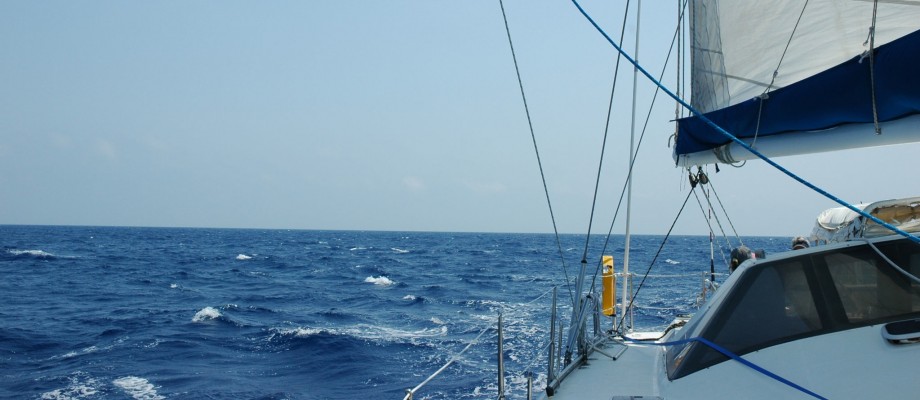
Around noon, we hoisted the anchor. There was a calm nervousness in the air. We would have to motorsail for about the first 12 hours before we would pick up the wind from the high pressure system.

Occasionally, we passed through patches of warm air pockets with a sulfur smell.

Justine was still suffering with a low grade fever. Colin eventually came down with the same symptoms, and both kids looked so miserable.

That night as we passed Tongatapu, we could see the glow of Nukualofa, and we could hear VHF chatter of boats getting ready to set sail the next day. We managed a scratchy chit-chat with s/v Sueño.

We finally found our wind.

day two:

After an uneventful night, morning arrived, and it was time to shake a reef from the main. Wil was in position at the mast, and I was at the helm. The plan was to turn the boat into the wind, so Wil could hoist the sail. Something we had done hundreds of times. That next moment changed the remainder of our passage for us.

I pushed the “standby” button to disengage the autopilot. The helm wheel stopped moving and froze in a fixed position. Wil was confused about my delay to turn into the wind, and I quickly informed him of our slight problem. Then, I re-engaged the autopilot, and the helm moved in response to the autopilot. When I put the autopilot in standby mode again, the autopilot stopped driving, but it wouldn’t release the helm. This was a problem!

Wil went into the engine room to have a look at the autopilot’s drive unit. He checked its temperature, as well as looked to see if anything was blocking its movement. He had me repeatedly engage and disengage the autopilot. Every time I disengaged the autopilot, I’d try to turn the helm. Each time, the wheel would reluctantly go a little further. Suddenly, the wheel let loose, and I finally had full control of the helm. However, from that moment on, the autopilot never engaged again. THAT was a problem!

With lack of a working autopilot, we felt lost. Both kids were sick with fevers, and Colin’s fever had spiked to 103 degrees F. While Wil would make attempts at troubleshooting the autopilot, I had the helm for most of the day. It didn’t take long for us to become exhausted.

We were only a day out from Tonga, but we had some serious issues. This quite possibly could be our toughest passage with respect to weather and sea conditions, and we already had a non-working autopilot and a very sick child. Therefore, I established a “point of return”. Sure, we could go back to our old 4-hour watch schedule and hand-steer. We had hand-steered many passages prior to ever having an autopilot. However, I needed to have control of Colin’s fever. If I couldn’t keep his fever down over the next 24 hours, we would need to return to Tonga. My fingers were crossed that the past history of this bug held true, and it would only last for 48 hours.

The rest of the day and night were spent adjusting to our shortened watch schedule. Temperature: 82-84 degrees F

day three:

Each morning, we report into the Southern Cross Net on the SSB. This morning, I reported our issues to the net controller. The autopilot was still non-functional, and Colin’s fever was still near 103 degrees. While, at that moment, we didn’t have a life threatening situation, I felt that we needed to let others know what was going on, just in case Colin didn’t get better. I spoke of our troubles and our plan, but finished my transmission with “ . . . but, all is well onboard.”

Almost immediately, other cruisers offered assistance. There was a pediatrician onboard another net boat if we needed a doctor. Several others offered up spare autopilot parts. Unfortunately, the most common autopilot out there was the electric Raymarine linear drive, while ours is a Garmin Type II Class B hydraulic linear drive. Other boats underway offered to meet us in Minerva Reef in order to give us any parts. We were so thankful for everyone’s help.

Since no one had Garmin parts, but we had an awesome weather window and were adjusting to a good watch schedule rhythm, we decided to skip Minerva Reef and run an almost direct rhumb line to New Zealand. Seven days is still far ahead for an accurate forecast (and they tell you NOT to take the short cut), but there was a huge high pressure that was dominating the area. We would have to motor for a couple of days in light airs, but we could safely get ourselves to New Zealand before the next low pressure showed itself.

As the day progressed, Justine’s fever disappeared completely, and Colin’s fever began to come down. We were relieved to know everyone was getting better. Wil even managed to bake a few loaves of bread. The air felt like fall. The sun was warm, but the breeze was cool. Temperature: 78-80 degrees F

I was at the helm when Wil came to me with a question. Did I want the good news or the bad news first? I was confused about where he was going with that, but I asked for the good news. The good news was that we had wind. And the bad news? The bad news was that his marbles were loose in his head. I didn’t know whether to laugh or cry!!

Loose marbles? That was our way of saying that Wil had come down with a case of vertigo. Over the past several years, Wil had experienced intermittent attacks of vertigo. He describes the feeling as one when you’ve had too much liquor to drink and everything spins around you. The spinning can be bad enough to cause nausea. Sometimes, his head spins just while lying in bed, and he can’t turn his head or sit up. It had been two years since Wil’s last episode, and he’d never had one while we were on the boat.

What were we going to do? We had two sick kids, no autopilot, and a captain down with vertigo! I literally didn’t know whether to laugh or cry. I did both.

We continued on.

I gave Wil some Bonine for seasickness, and he was able to function . . . barely. He would keep his watches, but without moving. He would sit on the floor by the helm with his hand on the wheel. In order to keep his head to a minimal motion, Wil would focus on the digital compass display of the autopilot, and he’d be able to maintain our course. If he even tried to look up toward the sails, or to the top of the mast, his head would start to spin. He was one tough guy, and I was ever so thankful that he was able to hang in there for us.

That night, I checked into the evening SSB net, and had a brief chat with Chris on s/v Yindee Plus. I gave him an update regarding boat and kids, but added Wil’s vertigo to the list. Regardless of everything, we weren’t in any danger, and all was still well onboard.

day four:

There were a group of boats about 40 miles ahead of us. When they heard the newest version of our story, a couple of them were ready to slow down and give us the extra crew members they had onboard. At first, I thought they were joking, but later, we learned that they were seriously ready to do just that. Again, we were touched by the generosity of the cruising community and our good friends.

By now, we were starting to tire, and we needed to make a change. Both kids were making significant improvements from their sickness, and we needed the extra hands. Therefore, rather than ask them to take the helm for little bits at a time, we started an official watch schedule that included the entire family. When it was their turn at the helm, they each did an 1 ½ – hour watch twice a day. That gave Wil and I six additional hours of down time per day.

The kids were awesome in holding their watches, and Justine even carried some of her hours into the night. We were so proud at how well the kids stepped up in time of need. Now, we can truly say that they earned their crew member positions by showing responsibility and hard work.

day five:

Things were starting to look up. The kids were doing their watches, Wil was feeling better, and we caught a Mahi Mahi. The weather had been kind to us through a difficult time.

We had started having late afternoon SSB contacts with the boats 40 miles ahead of us. On this day, each boat talked about how quickly the weather had changed on them. They reported fast approaching dark clouds, the sudden onset of 35 knot winds, and choppy 4-meter waves. Most of them barely got reefed down in time. One almost lost their dinghy when the boat surfed down a wave too fast and slammed into the wave in front, causing the dinghy to almost come free from its ties. They were all through the worst of it, but the seas were still up.

While I was listening to their stories, I commented on how we would be reefing down before nightfall. At that very same moment, Wil walked into the cockpit to do something. Justine was on watch at the helm and drew Wil’s attention to some dark clouds in front of us. One look at the wall of darkness told Wil that we needed to reef down ASAP, and I received the “get-on-deck-NOW!” call.

The next 12 hours were not fun. We were hit by one squall after another, and with winds from all directions. There was barely time to catch a breath between rounds. With each passing wall of clouds, the wind would die out and get shifty, then slam us with 30 knot winds from the opposite direction. We kept a triple-reefed main and a very small hanky of a jib, so we could easily change our course depending on the wind. We stayed as tight to the wind as possible, keeping the boat slow and in control as we sailed into steep and choppy 4-meter waves. At times, when the wind was fluky, we used our engines to maintain at least 4 knots and relieve some strain from the sudden wind blasts. With no autopilot, lots of rain, dropping temperatures, and shortened rounds of sleep, this is one night I can say that I hated being on watch.

This squall line was associated with a strong cold front that was moving through the area. Some of the others had known it was coming, but for some reason, I’d overlooked this little fact. Maybe we’d had too many distractions! Either way, they say everyone gets at least one bout of bad weather on this passage, and this was ours. I still considered us lucky. While it may have been miserable, it was still manageable.

I don't think I could put on another layer!

day six:

Temperature: 70 degree F inside the boat . . . colder outside

After the long night of squalls, we were quite relieved when daylight made its appearance. The waves were still 3-4 meters, but calmer and spaced a bit further apart. Every off-watch moment was spent trying to sleep.

day seven:

We saw a sail on the horizon, and two ships passed us by. Even though you’re on the radio daily with others who are somewhat nearby, it’s always nice to actually see another boat. You don’t feel so alone on the big, blue ocean. We also saw our first albatross, such a big and graceful bird.

The wind picked up and we had an awesome day of sailing at over 8 knots.

All well onboard, except for raining bearings from above. The topmost mast car broke, causing the bearings to pour out. The main was still functional, so the repair could wait.

day eight:

The wind became light, and we began the fully expected motor sailing. On the list of wildlife, we saw some dolphins, jellyfish, and another albatross. Spirits were up and we made pizza for dinner.

The nights were becoming unbearably colder!

day nine:

The center of the high pressure system was upon us. The ocean was a glassy, flat calm with absolutely no wind. There was a very long period 2-3 meter swell.

Colin was at the helm when we got a “FISH ON” call. We had an albacore tuna on the line. All of us immediately fell into our normal fish-retrieval duties. Justine used the book to identify the fish, I passed all necessary items to Wil who cleans the fish on the transom, and Colin reset the fishing line. We were all busy, doing what we do, when I happened to notice the helm. No one was driving the boat! Since we were motoring with no sails up, there was no way to know that the boat had fallen off course. By the time we realized that the boat had been left to her own devices, we were headed north. She’d done a complete u-turn and was headed on a straight course in the opposite direction. Maybe Full Monty wanted to return to the tropics!

The rest of the day was beautiful. The most spectacular was the hundreds of Man-of-War jellyfish that drifted past us. Yes, we were going that slowly! In order to conserve fuel, we were running one engine on low idle.

Before sunset, we could see a boat we knew on the horizon. Windara had departed Tonga a day later than we did, and they were able to close the 30-mile distance between us. We say it’s because we didn’t have a working autopilot, and it’s harder to steer a straight line!

first glimpse of New Zealand ~ the fresh, earthy smell was oh-so-wonderful!

day ten:

LAND HO! . . . at last!

Just as the sky was beginning to lighten, I could make out land on the horizon. With complete disregard for the time of morning, I walked around on deck knocking on everyone’s hatches. I just knew everyone would appreciate the first sight of land. Everyone was quite excited when they came up, but quickly disappeared in order to put on a few extra layers of clothes. We could make out the sweet smell of farmland. The ocean was even flatter and glassier than ever.

nice to have a monkey for minor repairs

re-threading the line for the courtesy flag

Just after sunrise, hundreds of Common dolphins swam up to greet us. Windara had caught up with us, and with boats side-by-side, we were all up on deck watching the dolphin show. At one point, we swear we even saw a shark fin in the middle of all the dolphins. We’re not sure if that’s even possible, but the fin shape and the way the animal swam spelled shark to us.

our New Zealand welcoming committee!

awesome tail-walking!

the more we cheered, the more they performed

Common dolphins seem to communicate with us

I could watch dolphins for hours!

slowly peeling the layers as the sun warms the morning


As we entered into the waters of the Bay of Islands, we had a major disagreement amongst ourselves. Colin and I were sure we saw a penguin. We remembered the penguins from the Galapagos and how they swam and floated at the surface. Wil and Justine kept trying to tell us it that maybe it was a different kind of bird. Later, we learned that we indeed saw a penguin . . . the little Blue Penguin. That should tell you how cold New Zealand waters are!

an Australasian gannet

entering Bay of Islands

Eventually, we arrived at the Quarantine Dock in Opua. The usual sense of overwhelming relief came over me. We’d done it! With a few good challenges along the way, we had pushed through with determination. The kids had stepped up to the helm and become crew members who we could depend on in time of need. Our family had grown closer.

From the moment 13 years ago when we began our plan to go cruising, through the moment that Wil hung up his boots, New Zealand had been our goal. We traveled a lot of miles, and experienced a great many things along the way. We had just sailed into New Zealand, and our goal accomplished. Our sense of achievement was huge and well-deserved. This day was a new beginning.

. . . all is well onboard

beautiful Bay of Islands

Categories: cruising kids, fishing, nature & wildlife, navigation, passages, weather | Tags: , , , , , | Leave a comment

passage to new zealand ~ the plan

November 9 – 18, 2013

For months prior to the passage to New Zealand, numerous cruisers fret over what could possibly be their toughest passage to date. With New Zealand lying between the Tasman Sea and the Southern Pacific Ocean, there are many strong low pressure systems that move across the region. One must also be alert to the fact that the beginning of cyclone season could come early, bringing a tropical system from the north.

Even though we had accumulated a wealth of weather knowledge over our months spent between French Polynesia and Tonga, we also talked to many experienced Kiwi and Aussie sailors, and read anything we could about how to pick a weather window to New Zealand. There is a very popular and quite helpful Seven Seas Cruising Association (SSCA) article written by John and Lyn Martin that does an excellent job explaining how to get yourself from the tropics to New Zealand.

Passage Planning: SW Pacific to New Zealand ~ July 2011

theoretical route to take from Tonga to New Zealand, with a stop in Minerva Reef (#4) ~ that was the plan!

Using the knowledge we had gained, we plotted the 1200-mile route we would take, and when the high pressure system came for us, we were ready for the 10-day ride.

return to home page

Categories: navigation, passages, weather | Tags: , , | 2 Comments

tonga ~ ha’apai & otu tolu groups

November 1 – 9, 2013

local Tongan outrigger canoe ~ Hunga Lagoon, Vava'u

Good-bye Vava’u: Clearing out of Tonga can be done in a few ways. Many people make their way to Tonga’s southern Tongatapu Group where they provision for the passage and then clear from Tonga to New Zealand. While still in Vava’u, we chose to fully provision in Neiafu, and then pay a visit to the immigration office. Vava’u immigration gave us our papers for final clearance from Tonga via the Ha’apai Group. We would only have to stop in Pangai on Lifuka Island in Ha’apai to finalize the paperwork.

Once we had our clearance papers in hand, we met up with a bunch of our friends for one last potluck on the beach in Port Maurelle. While we ate, there was much discussion about the weather window and when would be the best time to sail southward. The crews of Sueño and Full Monty agreed to sail for Ha’apai that night. As soon as we returned to our boats with full tummies, we proceeded with offshore preparations and our anchors were hauled for the 12-hour sail.

The shortest rhumb line to the Ha’apai Group is to sail south out of Vava’u. However, for a couple of reasons we chose to sail the western route. First, the wind was light, and we needed to have a course that put the wind more on our beam. Also, in order to have enough sunlight upon arrival to Ha’apai, we needed to sail at night. Tonga, and especially the Ha’apai Group, are known for their many dangerous and uncharted reefs. (We personally know a boat that ended up on one of those reefs in the middle of the night!) Therefore, we exited the Vava’u Group around the northern end of Hunga Island, and we sailed in the deeper waters down the western side of Tonga.

The night was calm and the sailing was easy. By mid-morning, we were making our approach to Haano Island in hopes of finding a not-so-rolly anchorage. As the day progressed, so did our distance traveled. We searched spot after spot, even dropping the anchor for lunch, but we weren’t satisfied with an anchorage until we reached the southern end of Uoleva Island.


Uoleva & Lifuka Islands: The islands of the Ha’apai Group are low lying and their anchorages are mostly unprotected from wind and swell. Therefore, it is highly recommended to only visit these islands when the winds are easterly and the swell is small. Even when it is calm, there is a constant swell that wraps around the islands and into the anchorages. The southern end of Uoleva Island has a large spit of land, plus additional reef which helps to enclose the anchorage, but it’s still slightly rolly. We never went ashore, but we had fun snorkeling along the surrounding reef. After two nights at Uoleva, we needed to continue our journey.

Before we could continue with any exploration and fun, we needed to make a quick 5-mile detour back up to Pangai to finalize our clearance from Tonga. s/v Sueño would be clearing out in Tongatapu, so they went ahead to scout out our next anchorage. We would meet back up with them by the end of the day.

The anchoring basin at Pangai was easy to enter, and easy for dropping the hook. We were the only sailboat among small, local fishing boats. We tied the dingy at the wharf and made the quick walk to the immigration office. We only knew the general direction to walk, but it was easy to get directions from any person passing by. Once completing the immigration process, we stopped at a small grocery on our way back to the dinghy. We didn’t have enough cash, so Wil was able to run to a nearby bank and return with the necessary money. Once official business was completed, we joined Sueño at Uonukuhahaki Island.


Uonukuhahaki Island: Our afternoon at Uonukuhahaki Island was spent relaxing. David & Wil went in search of lobster, Nathalie and I snorkeled and chit-chatted it up in the water, and the kids played on the beach and in the water. Unfortunately, the dads came home empty handed, but it was all still fun.


Numuka Island (Otu Tolu Group): The next day, we were ready to depart Uonukuhahaki Island, and we’d chosen Numuka Island in the Otu Tolu Group as our next destination. However, the day was overcast with some drizzle, and it’s nearly impossible to move a boat around the Ha’apai and Otu Tolu Groups without the sun to light up the treacherous reefs. Ideas were tossed around, and then we finally settled on making a daring dash to the nearest pass, Ava Mata. Once outside the pass, we would sail down the reef to the next pass, and fish along the way.

Fishing along the barrier reef in the southern most Ha’apai Group was the most incredible fishing we’d had since the Marquesas in French Polynesia. Both Sueño and Full Monty pulled in fish after fish. There were tuna, jacks, mahi mahi, and barracuda. They were plentiful, and they were big. We actually got tired of the “FISH ON” call! It was awesome!

Luck continued to be with us. As we got to the end of the Ha’apai barrier reef, and needed to enter the scattered islands of the Oto Tolu Group, the sun came out. We were able to eyeball navigate our way to Numuka Island. However, once we got there, we had a difficult time finding an anchorage that was protected from the wind and without too much coral. After circling Numuka Ika a couple of times, we finally dropped the hook on the island’s east side and behind a reef. All were exhausted from the day’s fishing excitement, but some of the crew still managed to swim and explore ashore.


Kelefesia (Otu Tolu Group): Our final Tongan island before the impending New Zealand passage!

Approaching wild and beautiful Kelefesia Island requires strict attention to navigation. Over the past couple of years, we’ve grown accustomed to using eyeball navigation with respect to reefs. However, we had never before come across “blind rollers”. We saw blind rollers labeled on the chart and wondered what exactly that meant. It didn’t take long for us to find out.

As we were looking for our final turn toward Kelefesia, the water between us and the anchorage appeared to be deep enough. We had about 10-15 knots of wind with a 2-meter long period swell. According to the chart, where the blind rollers were supposed to be, we could see nothing but water that was deep enough for us to cross. I was at the helm, and Wil, while keeping a watchful eye from the bow, indicated for me to make our turn toward the anchorage. I was nervous and unsure about our premature turn, and for good reason. Just as we were getting ready to cross the “blind rollers” area, some swell moved through. Suddenly, the normal, gentle swell stood up to a steeper, 3-meter wave as it went from the deeper water to the shallower reef at about 5 meters deep. Thank goodness, I managed to make the hard turn back to starboard before getting caught in the steeper wave! Once we got ourselves back to where we needed to be, and around the blind rollers, we looked back at them and could fully appreciate their meaning.

notice the area of "blind rollers"

lots of reef & coral on every approach!

Our time in Kelefesia was mostly spent preparing ourselves and the boat for the New Zealand passage, and spending some last minute quality time with our good friends on s/v Sueño. Sueño’s next stop would be Tongatapu, where they would exchange Nathalie & Noemie for one crewing uncle. The girls would get on a plane to New Zealand, while David, Nathalie’s uncle, and the boys would sail the boat. When we departed Kelefesia, we would be sailing directly to New Zealand, with a possible stop in Minerva Reef.

Boat preparation included the normal offshore preps (running jack lines, checking engines, making sure everything was secure and stowed, etc). However, this time we also needed to go through all of our provisions and bring out foods that wouldn’t be admitted to into New Zealand. I placed a bin of such foods in the main salon, and our goal was to consume the majority of those foods prior to arrival in New Zealand. We also needed to make sure we weren’t carrying any critters (especially in wood products or baskets), so the boat received a good cleaning prior to our departure.

Part of our mental relaxation was achieved by snorkeling the area, and as usual, the kids usually played on the beach or in the water. The surf surrounding Kelefesia looked amazing, and if we weren’t getting ready to depart for New Zealand the next day, Wil would have taken a board out. We wanted no injuries or infections to deal with on the passage.

Unfortunately, other kid boats back up in Vava’u had been kind enough to share a cold virus with everyone. Eventually, the Sueño kids suffered from the bug, and then the night before we were to set sail for New Zealand, Justine fell sick with a low grade fever and general cold symptoms. (Looking back at our past history of big passage departures, this came as no surprise!) Based on the knowledge that other kids only suffered with a fever for no more than 48 hours, we felt like it would still be okay to keep our departure for the following day.

Little did we know, the passage to New Zealand would bring us some of our most challenging moments . . .

northern tip of Kelefesia Island

southern tip of Kelefesia Island ~ 1/2 mi from N to S

looking NW from Kelefesia ~ lots of reefs!

a tricky anchoring between reef & coral heads

Kelefesia is a rugged & wild beauty

yellow-lipped sea krait

sea snake trying to board the boat & dinghy

pigs ~ for when fishermen stay on Kelefesia

building a nest somewhere

birds collecting debris for their nests


return to home page

Categories: fishing, nature & wildlife, navigation, passages, travel | Tags: , , , , | Leave a comment

tonga ~ odd & end photos

October 1 – November 1, 2013

It’s time to wrap up our visit to the Vava’u Group of Tonga. There are so many more stories and experiences to write about, but it’s time to move on. Therefore, here are some odd-and-end photos taken in Vava’u.

laundry ~ stomping makes a good heavy duty cycle

kids don't mind lending a foot

broken ribs keep David (s/v Sueno) only able to watch the fun

thrilled to be knee boarding

northern Hunga island ~ typical landscape of Vava'u islands

western Hunga Island of Vava'u Group

staying protected from the sun

checking the rig near Vakaeitu Island

great snorkeling between Vakaeitu & Langito'o islands (Moorings anchorage #16)

Anchorage #16 ~ Cats anchored in ~2-3 meters. Monohulls can anchor in ~10-15 meters.

anchorage #16 ~ looking toward Langito'o Island

Categories: cruising kids, living aboard, travel | Tags: , , | 2 Comments

tonga ~ cave & snorkeling explorations

October 1 – 27, 2013

Photos of some of our Tongan cave explorations and snorkeling expeditions.

Swallow’s Cave ~ northwest tip of Kapa Island, Vava’u

approaching Swallow's Cave

swallows fly near the opening at the top

inside entrance cavern of Swallow's Cave

some graffiti dates back to the 19th century

looking from the inside of Swallow's Cave, out to the main entrance

Climbing thru swallow & bat guano. Wil accidentally fell into it. We won't describe that scenario!

a crazy & quite talented Chris (s/v Tribe)

Mariner’s Cave ~ a hollow in the rocks near the northern tip of Nuapapu Island. The cave can only be accessed from under the water. At low tide, the entrance to the cave is about 2 meters below the water’s surface. In order to enter the cave, a person must time their dive with the incoming surge of the swell, swim down 2+ meters, swim laterally about 4 meters under the rocky ledge, and then surface inside the cave. Once inside the cave, huge changes in air pressure are experienced with each surge of swell. When the water surges into the cave, the air within the cavern compresses, becomes extremely foggy, and the pressure builds in your ears and head. Then, the water goes down with the outgoing surge, and the air becomes clear and your head relieved.

A good test to see if you’re capable of such a swim: Start from about a meter away from one side of your boat, swim down under the keel, and surface at least a meter away from the other side of the boat. Even better if you can do it under a catamaran!

from inside Mariner's Cave looking under the rock ledge entrance to the outside

Guillaume (s/v Sueno) having fun under the rock ledge to Mariner's Cave

compressed air inside Mariners Cave

uncompressed air when the water goes out

Hunga Lagoon ~ Hunga Island, located on the western-most side of the Vava’u Group, has an interior that is mostly deep lagoon. Just outside the entrance to the lagoon, there are incredible coral encased rock formations that create a fun maze to snorkel.

Justine swimming the coral mazes outside Hunga Lagoon


Categories: nature & wildlife, travel | Tags: , , , | Leave a comment

tonga ~ a weather situation

October 8 – 11, 2013

During a stormy night in Tonga, there are a handful of us who learned or were reminded of some extremely valuable lessons when it comes to boat and crew safety with respect to Mother Nature. Luckily, our group of boats and crew were unharmed, but sadly, a local fisherman lost his life that night, leaving behind a wife and children.

Before I jump to the details of that heart-pounding night, using my simplistic terms, I’ll begin with a little information about weather forecasting in the tropical South Pacific, as well as how we obtain weather reports onboard.

Every morning when I first wake up, I boot up the laptop computer and pull in a weather report via the HF radio and Pactor modem. Most regularly, I look at a grib file, a Spot report, and a Nadi Fleet Code map.

recent grib file (extra large) showing our position, wind speeds, air pressure, wave heights, and precipitation

This particular grib file is quite large, and not one I would normally pull in over the radio waves. Usually, I receive a smaller grib file only showing our immediate island group or an area we’ll sail within the few days to follow.

example of Spot information

an email containing Nadi Fleet Codes

The above example of a Spot forecast shows (from left to right) date, time (utc), air pressure, wind speed (knots), wind direction (degrees), and rain (mm/hr). The blank column normally shows wave height (meters) and wave direction (degrees). I can either look at the forecast based on our current position, or I can request a forecast for a given course and speed over time.

When I recieve the Nadi Fleet Codes, I copy and paste them to a text only file. Then, I open the Nadi Fleet Code file in a PhysPlot map.

PhysPlot map using Nadi Fleet Codes ~ shows isobars (black lines), high & low pressure systems, air pressure, frontal lines (blue) & convergence zones (brown)


Once I have all of this information, I mentally create my own forecast for what is really going to happen. While all general weather information is given, it is necessary to fill in some blanks, especially with respect to the South Pacific Ocean.

Firstly, the grib files and Spot reports usually underestimate the actual wind speed, and the percent error increases exponentially as the forecasted wind speed goes up. Forecasts give wind speed at approximately 10 meters above mean sea level and the wind is stronger higher up. Also, weather forecasts are most accurate up to 24-48 hours.

As general rule, wind can be estimated as follows:

  • add 1 Beaufort Scale level for the sake of planning
  • add 20% to the wind speed for a mast taller than 10 meters (ours is ~22 m)
  • add 20% for the maximum wind gust
  • add 10% for the Tropics or add 25% in temperate latitudes and the Southern Ocean
In the South Pacific, when Force 6 winds are forecasted, don’t be surprised to see Force 10 wind gusts!

Other factors that come into play are the South Pacific Convergence Zone (SPCZ), low pressure systems, and frontal boundaries. A combination of any of these can wreak havoc on the weather, especially when all three are involved.

  • The SPCZ: In the tropical South Pacific there are areas where east winds from the equator diverge toward the south and bump into southeast trade winds. These areas where the two winds converge are referred to as the South Pacific Convergence Zone (SPCZ). Shifty winds, strong squalls with 30-40 knots of wind, and heavy rain can be present in these unsettled areas. There is very little affect north of the zone. However, up to about 120 miles south of the zone, the strongest winds are felt.
  • A Low Pressure System: A low pressure system is an area where winds rotate around an area of low air pressure. In the Southern Hemisphere, these winds move in a clockwise direction around a low pressure center. The lower the air pressure falls at the center, the deeper the Low becomes, accompanied by stronger winds and heavier rains.
  • A Frontal Boundary: A front is the boundary between two air masses or systems. In this area, there is an abrupt change in the direction of winds at the Earth’s surface. The larger the air pressure or temperature gradients are between the two air masses, the greater chance for more severe weather.
on the left ~ an example of a convergence zone (brown twig) being pulled into a low pressure system (closed circle) with a frontal boundary (red)

Prior to the severe weather that hit us in Tonga, grib files, Spot forecasts, and weather maps were showing a strong low pressure system approaching with a leading frontal edge. A strong convergence zone was also being drawn into the already intense low. The center of this Low was forecasted to pass directly over us, with a full clocking of winds. The grib file and Spot showed that, during the time period with the strongest wind, our forecasted wind would be 27 knots out of the southwest.

At that point in time, none of us had any idea of exactly how strong the wind would get that night. Knowing what I know now, and using the general rule described above, the strong winds that we experienced are completely understandable.

We all knew this weather was coming, and we knew we needed to tuck up somewhere with good anchor holding and protection from the strongest wind. At the same time that we needed to think about the bad weather, there was also a birthday party in the works, and a good beach was needed for all the planned kid activities. Over the few days prior to the weather event, we tossed around anchoring ideas, and also personally visited a few possible anchorages. When we thought the group had settled on one spot, another idea was added to the pot.

Eventually, the anchorage at Kenutu Island (Moorings anchorage #30) was chosen because there was reportedly good holding and a good beach. However, this anchorage is wide open to the southwest, and there were some of us who were not comfortable with the situation.

Coming into the anchorage, Wil and I had decided to remain open minded, but we were prepared to say no to the birthday party and go elsewhere if we felt unsafe. One boat that was arriving after us, called ahead with a couple of good questions concerning the protection of the anchorage, but they were assured that this anchorage was fine for all wind directions.

After having looked at the chart ahead of time, and prior to a final decision on our anchor spot, we explored the entire area within a mile of the birthday party location. We even checked out the area where a few of the boats were already anchored by the beach. It only took one drive-by for us to realize we didn’t feel good about being wide open to the potential southwest winds. We decided on our first pick, one mile to the northwest at the northern tip of Ofu Island.

Using brown anchor symbols . . . Our anchor location at northern Ofu. The rest of the boats anchored near southern Kenutu.

southeast Kenutu is wide open to the SW with only small reefs & sand banks to break up any wave fetch

Based on our decision to participate in the birthday party activities, we remained in the area and made the best anchoring choice we could with respect to the possiblity of strong SW winds. There are a few reasons for our anchoring choice.

1) By squeezing up as close to the NE end of Ofu, the island and a small spit of reef offered protection to the SW.

2) With a SW wind, in case the anchor were to drag, we would have more time for reaction before ending up on coral reef, rocks, or a beach.

3) The strongest winds were predicted for middle of the night. We had easy access to deep water in the event we needed a quick escape.

our anchor spot at northern Ofu Island

looking to the SSW from our anchorage

looking across to the southern end of Kenutu Island ~ can barely make out the other masts

evidence of unsettled weather rolling in

Sure, we had to dinghy a mile to the birthday party, but it was worth it. All the kids, as well as the adults, had a wonderful time with lots of fun games and plenty of good food. Eventually, it was time to return to our boats for the night and await the expected weather. Around 10 pm, we noticed lightening on the horizon to our southwest. Wil had hoped that meant most of the storm was missing us. After taking some mental bearing points (i.e. the other mooring lights and especially one little light on a tiny island nearby), we went to bed.

Midnight was the witching hour.

The strengthening wind woke us from our sleep. It didn’t take us long to realize that this was not your ordinary passing squall. The howling sound of the wind through the rigging was loud enough to rattle anyone’s nerves. The sheet lightening above blinded us with its brightness. The horizontal rain pelted any exposed skin when we tried catch a glimpse of our wind speed at the helm. At first glance, 42 knots easily! We suddenly felt the anchor make a couple of hops before it re-grabbed again.

Even though our adrenaline had kicked us into high gear, and I could still think and function normally, my arms and legs shook uncontrollably, almost as though I was cold . . . but I wasn’t. I also had to pee . . . badly! It never fails for me. The urge to pee is the first thing I need to do when I first get out of bed. But, when the winds were blowing near 50 knots, and there was potential for disaster, there was no time to even think about going to the head. Our boat needed our fullest attention.

Using a mask and snorkel for facial protection (and to be able to see!), Wil went forward to check on the anchor and bridle. The one-foot wave fetch was choppy, but the island and small spit of reef protected us from the bigger waves. The anchor chain and bridle remained completely taut with the wind. The strains on the anchor chain, bridle, and boat were tremendous. I suggested we use the engines in low idle to relieve some of the strain, and that seemed to put the boat at ease.

While we had chosen a more protected location than the other boats, the storm was no picnic. We could only imagine what the others were going through. When the storm was at its strongest, we couldn’t even make out the mooring lights across the water.

The wind had kicked up at midnight. We were completely on edge as it blew near 40 knots, gusting to 50 knots (58 mph), for nearly an hour. Both of us remained in the cockpit with the engines running for that first hour. Our nerves began to calm during the second hour, when the wind dropped into the 30 knot range, gusting to 40. We didn’t feel out of the woods yet, but we finally turned off the engines. We’d go inside for longer periods, but keep a close eye on the AIS anchor watch. It took until the third hour when the wind finally dropped into the 20 knot range, gusting to 30 before we could settle another notch. By this point, there was no need for both of us to remain on watch. While I went to bed, Wil slept with his head down on the nav table, so he could hear if the anchor watch alarm sounded.

This night was also the opening night for a big regatta weekend in Tonga. Many boats had gone to Neiafu Harbor for the festivities. The wind had ramped up about the same time that many intoxicated sailors were trying to make their way back to their boats. While we had been busy keeping watch on our situation, we could hear lots of VHF chatter. People were attempting to dinghy back to their boats during the strongest winds, and they weren’t able to go against the wind. Also, since Neiafu Harbor was so crowded with boats, and many moorings are too close together, people were having a difficult time keeping boats apart from each other. While Neiafu was more protected than our side of Vava’u, the harbor had its own sort of chaos.

The following morning was that beautiful calm after a storm. We were relieved it was over and ready to pick up where we left off. While it was still early, we noticed a local boat motoring around. The guy came over to see if we were okay. He was from the Mandala Resort on Fetoko Island, and he was checking for anything out of the ordinary. He noticed that we were not in a normal anchorage spot and wondered if we’d washed up on the reef. We were very happy to tell him that all was okay, and also thanked him for leaving their light on throughout the night. It was the only light that had remained visible for keeping our bearings during the storm.

Over the next several days, we learned a little more about that night. The boats that had anchored at the south end of Kenutu Island had a far worse experience than us. They were the receiving end of wave fetch over a meter high. As the boats hobbied up and down in the waves, their bows went into the water with each wave. There were reports of broken snubbers, dragging anchors, and attempts to re-anchor. Most of them had beach or coral reef behind them, so they had very little reaction time. A couple of boats who were better off than the rest, realized that they should have known better than to put themselves in such a situation. Everyone has agreed that this was something never to repeat.

After the stormy night, regatta activities continued throughout the weekend. Eventually, many boats (both spectators and race contestants) gathered near Mandala Resort. After the regatta, the people who run the Mandala Resort began checking to see if any of the regatta boats were missing a crew member. They had found a man who had washed up on their beach, and they were trying to identify him. Later, it was discovered that he was a local fisherman whose boat had overturned in the storm, and he drown because he didn’t know how to swim. The restaurant on Tapana Island hosted a major fundraising dinner in order to raise money for his grieving family. While we were unable to attend, we had heard that the dinner had completely sold out due to the overwhelming support from the cruisers.

many regatta boats anchored near Mandala Resort

Polynesian sailing canoe catamaran

Sailors, fishermen, and other mariners, we are all people of the water. We must respect the forces of Mother Nature and prepare for her the best we can. No matter what, the sea remains our passion.

return to home page

Categories: electronics, weather | Tags: , , , , , , , , , , | Leave a comment

explanation of position reporting problem

Over recent weeks, it has come to our attention that our position has disappeared from the map. Several of our good friends and readers have become concerned as to our whereabouts and our well-being. Rest assured, we are still on the globe and all doing quite well.

Every time we are sailing on a major passage, or even just moving across an anchorage, I remain dedicated to reporting every important change in our position via Winlink. However, lately there have been some technical issues that are beyond our control. We received the following email which explains the situation.

To all Winlink maritime users:

We have received reports that position reports you have posted through Winlink are not displayed on Shiptrak.org, Yachttrack.org and perhaps other services. In addition, the 14300.net Position Reporter and other web input tools used by net control operators to manually enter position reports from voice contacts are inoperative. If this affects you or others who need to keep track of your position and well-being, we want to explain.

Your position reports posted using RMS Express or Airmail go directly in to the Winlink system’s database and are displayed using our web application, available from a link at

http://www.winlink.org or http://www2.winlink.org:8081/maps/positionReports.aspx.

A history of one user’s position reports can be viewed by using this variation:

http://www2.winlink.org:8081/maps/positionReports.aspx?callsign=[callsign]

Additionally, when you post a position or WX report, we echo it actively to MAROB (the US Weather Service marine weather report intake program), YOTREPS (http://www.pangolin.co.nz/yotreps_reporting_boat_list), and the APRS internet network (view at http://aprs.fi and on other APRS sites and software).

Winlink, YOTREPS, and APRS displays continue to work properly.

Independent services who pull or post positions from/to the Winlink database may temporarily miss data until their authors can make upgrades to their software. We recently upgraded our database interfaces for security, and although we have provided all upgrade technical information to the various third-party program authors not all have completed the needed changes. We have no control over these systems, but please be assured we are providing help to the authors who request our assistance, and are attempting to motivate their work. Keep in mind most are volunteers like ourselves.

Meanwhile, we encourage you and your correspondents to use the working display services mentioned above. We thank you for your tolerance of any service interruption our third-party partners have experienced.

73,

The Winlink Development Team

I have played around with the suggested sites mentioned in the above email. While the system still seems to be a work-in-progress, I have added APRS and Yotreps links to the “see us on the map” section on the right side of our blog. These positioning maps don’t show as many positions as Winlink, but at least you can see our most current location.

As for the SPOT, their positioning system doesn’t cover the middle of the Pacific Ocean. Therefore, the SPOT reports probably won’t show up again until we near Hawaii. (OOPS! Let that cat out of the bag! For those of you who didn’t know . . . Yes, we’re working our way towards Hawaii. More on that at a later date.)

Also, in case some of you are wondering, I want to clarify another important issue. Due to the fact that we only get occasional internet, and that we spend a lot of time having fun and exploring our surroundings, the actual blog posts are way, way, way behind. (Someone even told me that it was a disgrace to be so far behind!) I wish I had it within myself to shortcut the posts and only touch on the highlights. However, I can’t bring myself to leave out information or good stories. Therefore, I continue to write more informative posts, and when we have internet, I use Twitter feeds in the “up-to-date tweets” section to keep everyone apprised of more current happenings.

Hopefully, questions have been answered and worries have been calmed. Most importantly, and to the best of my ability, I pledge to keep the blog posts coming . . . even if they are sporadic and way behind.

return to home page

Categories: navigation, newsworthy | Tags: , , , , , | Leave a comment

tonga ~ the nature of it (whales)

October 2, 2013

Immediately following the first sea snake encounter in Swallow’s Cave with s/v Gallivanter, our afternoon became even more incredible and turned into one that we will remember for a lifetime.

We were just finishing up snorkeling in Swallow’s Cave when we noticed s/v Sueño making their approach to Neiafu for clearance into Tonga. From the dinghies, we hailed them on the VHF, and they sailed over to say hello. While we were chit-chatting, in the distance we noticed a humpback whale with a young calf playing by her side. Sueño dropped their dinghy in the water, and we all rode out in the direction of the whales. We noted that the time of day was 5:05 pm, and knew that all the whale watching tour boats go “off duty” at five o’clock. We’d heard stories about how the whale watching boats don’t like cruisers to whale watch without paying for a tour, and we didn’t want a confrontation with any of them.

It is common knowledge not to get too close to a mother whale with her baby, so we stopped the dinghies quite a distance from the whales. We turned off the engines and let ourselves drift, watching the whale spouts and admiring the playfulness of the babe from afar. The setting sun was creating a glare on the water, so we really had to squint to make out the whales. After several minutes, we noticed mom and babe making their way toward us. We chose not to move and we waited to see where they would go.

Suddenly, the massive humpback whale mother, with her babe by her side, surfaced right near us! I think we all gasped in disbelief simultaneously, and then the situation became even more amazing. The mother whale gently escorted her baby along the water’s surface guiding it between our dinghies. It seemed as though she was either sharing her baby with us, or using it as a teaching moment for the young whale.

mother humpback whale with a calf by her side (notice mom's 15-foot flipper!)


Most of us quickly donned the snorkel gear and slid into the water to get a closer look. Although, I think Tam and I had the best view from above. Definitely a breathtaking moment and one I won’t ever forget. While the water was fairly clear, it wasn’t clear enough for the swimmers to see the whales until almost upon them. I had to yell at Colin to stop swimming because he was headed right for the path of the oncoming whales. Then, Wil had to grab Adam (s/v Gallivanter) and physically stop him before he swam straight into the whales.

Once I was sure that the whales were not posing any harm to the rest of the swimmers, I got into the water, and with dinghy in tow, started to swim toward the whales as well. As I had entered the water, out of the corner of my eye, I noticed a motor catamaran speeding in our direction, but I didn’t think anything of it.

Seconds later, Tam was standing in her dinghy frantically waving her arms to alert the driver of the motorboat that there were swimmers in the water. The driver nearly ran her over, came close to everyone in the water, and after causing the whales to dive rapidly, stopped his boat right where the whales had been. His big voice repeatedly boomed in our ears, “GET OUT OF THE WATER!! YOU’RE BREAKING THE LAW!!” I quickly hopped back into the dinghy and asked as nicely as I could if he would tell us the law. “IGNORANCE IS NO EXCUSE!” he yelled and ordered his crew member to start taking our pictures.

As the guy continued to yell, everyone scrambled back toward the dinghies. There was no reasoning with him. My heart was racing. Had we broken a Tongan law? Would we be reported? They had photos of us, but would they be able to identify us? However, we suspected he was merely trying to intimidate us. He claimed to pay $4000 each year for his license, and if we wanted to whale watch we needed to do it through a company. Later, we all agreed that if we were to pay for a whale watching tour, it would not be with him. If we’d been asked nicely to get out of the water, and if any rules had been explained to us, then we would have happily obliged.

Regardless of this man who we refer to as Angry Santa, we all had the most incredible up-close and personal experience with a mother humpback whale and her baby. She had actually brought her baby to us, and we will never forget that. It was more than worth it. If any whale watching laws were broken, it was done by the Angry Santa in his whale watching boat. He is the one who put all of us and the whales in greater danger.

For each day that we spent anchored in Port Maurelle, we were able to watch the whale spouts and breaching of this mom and baby from the distance. It was a beautiful sight.

During the remainder of our stay in Tonga, as we sailed between the Vava’u Group islands, we had a few more whale sightings. One time, we were sailing along the western shore of Hunga when we saw some whale spouts a long way ahead of us. We attempted to catch up with them, but then we couldn’t find them anymore. We finally gave up, and made our turn to the lagoon entrance. Just as we turned, two humpback whales surfaced behind us. It was as though they had been playing hide and seek with us the whole time!

return to home page

Categories: nature & wildlife, travel | Tags: , , | Leave a comment